What state is Mexico? Map of Mexico in Russian. The most dangerous states
Mexico as a state is officially called the United Mexican States. The mere mention of this state evokes many different associations. For example, today the States of Mexico are known for their resorts on the Yucatan Peninsula, or the long coastline of the western states on the Pacific Ocean. Some people call Mexicans “Aztecs.” Others will remember the Mayan Indians who lived here. The result is a very diverse country with a rich history.
In the 2nd millennium BC, on the territory of modern Mexico, a state formation of the Mayan Indians was formed, which existed and grew until the 10th century AD. It was a highly cultural nation, very developed in various exact sciences, including engineering and mathematics, as well as construction. The Mayan Indian tribes occupied most of the southern part of Mexico, including the island of Yucatan.
In the central part of the state, in the pre-Columbian era, another state formation of the Aztecs developed. Basically they lived divided into tribes and were a very warlike people. From 1376, until the beginning of the 16th century, which was marked by the Spanish Conquest, few could provide worthy resistance to the Aztecs. But in 1521, their last emperor was defeated and the city of Tenochtitlan was destroyed. Nowadays the current capital of Mexico, Mexico City, stands on its ruins.
Then began a long period of colonization from the Spanish metropolis. During this time, due to hostility and introduced European diseases, most of the local population died out. Some territories were captured without much destruction. Some were completely turned into ruins. From 1521 to 1810, the period of New Spain lasted in Mexico. During this time, many European values and culture grew here. Active construction of cities was underway.
After 1810, with the gaining of independence and the proclamation of the Mexican Empire, which included the territory of modern Mexico and part of the currently existing Central American states. It did not exist for long, until 1823, when part of the southern territories separated from the empire. The key year for modern Mexico, from the point of view of the political and state system, was 1824. It was then that the republican constitution was adopted, which marked the creation of a federal state. 19 states and 4 territories were created.
About ten years later, the Mexican state of Texas separated and formed its own republic, which later became part of the United States. There was unrest in other states as well. The struggle for power between liberals and conservatives had a negative impact on the integrity and economy of the state. So in the 50s of the 19th century, the state of Yucatan actually formed its own separatist republic. At the same time, a war was waged between Mexico and America due to the former Mexican state of Texas becoming part of the latter and US claims to other states of Mexico. As a result, after the signing of the corresponding treaty to end the war, New Mexico and Upper California became part of America.
The endless civil wars of the second half of the 19th century prompted major European states to send their armed forces to establish order in Mesquique. By the end of the 1800s, the situation in the country had somewhat stabilized, but Mexico became increasingly dependent, economically, on the neighboring United States. The state was also restless in the first half of the 20th century, until the end of World War II, after which the economy and new reforms made it possible to improve the situation.
Today Mexico is divided into 31 states. The capital, Mexico City, has the special status of a federal district. It is the political, economic and cultural center of the United Mexican States. For more than two hundred years, the territory of Mexico has been constantly changing, and the number of states with their administrative boundaries has changed accordingly. The boundaries and names of all modern states of Mexico were finally established in 1974, when the creation of Baja California and Baja California Sur, located on the peninsula of the same name, was finally approved.
6 states with famous cities

The administrative center of the state of Chapala is the second largest Mexican metropolis -. Jalisco is also home to Mexico's largest freshwater lake, Chapala. Although it is mostly shallow, with an average depth of about 5 meters, and its natural resources have diminished over the years, it still provides habitat for many migratory birds.

The administrative center and largest city of the state of Guerrero is the world famous Acapulco. Despite the rather low level of the state's economy as a whole, Acapulco is the most delicious place for tourists coming to the west coast of Mexico. Long beaches, a unique bay for ships, and rocky areas make the city the most developed resort on the Pacific coast. The fact is that since the 50s of the last century, many Hollywood stars loved to come here on vacation. However, large investments from the country's state budget, the construction of luxury hotels along with hotels for poor tourists and the general development of infrastructure have made the resort accessible to tourists of all categories.

is a popular city in southeastern Mexico on the northeastern coast of the Yucatan Peninsula in the Mexican state of Quintana Roo. The city is an important tourist destination. The city is located on the Caribbean Sea and is one of the most eastern points of Mexico.

The city is located in the heart of the country in the Federal District of the same name. It is the political, economic and industrial center of Mexico
Monterrey is the capital and largest city of the northeastern state of Nuevo Leon, Mexico. The city is the ninth largest city in the country. Monterrey is the commercial center of northern Mexico and is home to many significant international corporations.
Tijuana is the largest city in the Mexican state of Baja California. It is Mexico's largest and fastest growing metropolitan area and has a strong influence on the local economy, education, culture, arts and politics.
The most dangerous states
 It is Mexican laboratories that operate north of the border that supply most of the methamphetamine.
 The United Nations estimates that nearly 90% of the cocaine sold in the United States originates in South America and is smuggled through Mexico.
Mexico is the largest foreign supplier of marijuana and the largest source of heroin for the US market. Most methamphetamine sold in the United States is produced in Mexico
Hot spots for drug cartel activity and human trafficking are:
- Tamaulipas on the US border;
- Sinaloa;
- Colima;
- Michoacan;
- Guerrero.
The last four are located on the Pacific coast.
Tamaulipas shares a border with Texas, stretching from the Gulf of Mexico to Laredo. The State Department has previously discouraged travel here, but the new warnings are even more serious because the state has been designated Level 4, the highest level of potential danger.
Another 11 Mexican states have received Level 3 status, prompting people to reconsider their planned travel itinerary.
Colima has seen a spike in murders in recent years due to the rise of cartels. It now has the highest murder rate in Mexico, with 83.3 murders per 100,000 inhabitants.
The state with the second highest murder rate, 61.6 per 100,000 people, is Baja California. It is home to the popular resort of Los Cabos, which saw an 18 percent increase in tourist arrivals in 2017.
Esponda said local officials and tourism operators are investing in improved security, including camera systems and the construction of a new maritime base.
Here are the most dangerous states in America for 2018:
- New Mexico;
- Alaska;
- Louisiana;
- Arkansas;
- South Carolina;
- Tennessee;
- Alabama;
- Arizona;
- Oklahoma;
- Missouri.
Top 5 crime states in the USA:
- New Mexico has the highest crime rate. It is one of the least densely populated places in the country. The number of violent crimes per person is the second highest, and the number of property crimes is the highest in America.
- Tennessee has the 4th highest violent crime rate. Over the past year, there have been 2,700 reported rapes a year here, which is about 7 a day.
- Louisiana – 2nd place. This is one of the poorest states, in which the connection between poverty and crime is clearly visible, because in Louisiana most of the population lives below their means.
- Arkansas ranks 4th. It is another poor state in the south with much higher rates of murder, rape, assault and robbery per capita. Over the course of the year, more than 7,100 cars were stolen here.
- South Carolina - 3rd place. There is a lot of property crime here, especially in places like Myrtle Beach, which is a major tourist hotspot. Many crimes and thefts occur in the summer, which is associated with the seasonal influx of tourists.

The border between the United States and Mexico stretches nearly 3,300 km from the Gulf of Mexico to the Pacific Ocean. The Rio Grande runs for over 2,000 km and has no natural geographic barrier, except for a small section along the Colorado River. About 1,100 km more of the border is barbed wire between the United States and Mexico.
The US Border Patrol uses thousands of cameras and underground sensors, as well as aircraft, drones and boats to monitor the border.
United States of America bordering Mexico:
- California: Baja California;
- Arizona: Sonora;
- New Mexico: Chihuahua;
- Texas: Chihuahua, Coahuila, Nuevo Leon and Tamaulipas.
The "US-Mexico border" is relatively new. Its construction lasted between 1849 and 1855. The border can rather be called a porous membrane through which a huge amount of money, prohibited products, illegal immigrants, smugglers and their goods, as well as drugs pass through. That is why the area here is under the most concentrated police attention. Conditions here are also worsened by extreme heat and water shortages.
The busiest border crossing points:
- San Isidro;
- El Paso;
- Calexico.
San Ysidro - The state of California is connected to Tijuana, Mexico. The number of people who cross the border through the bridge is approximately 8 million people. Every day this is about 30,000 people on average. The San Ysidro Port of Entry is one of the busiest crossings on the US-Mexico border.
In 2015, San Diego opened an additional airport terminal that allows people to be transported from the city of San Diego directly to the Mexican airport, easing wait times at the San Ysidro Bridge.
The El Paso gateway serves approximately 8 million people, averaging 25,000 per day. It connects El Paso, Texas and Juarez, Mexico. The Paso del Norte Bridge was originally built in the 1800s, although it has since been rebuilt. Between 600 and 1,000 children legally cross the Paso del Norte Bridge to go to school each day, according to Customs and Border Protection data.
The port at Calexico provides border crossings for 4.5 million people, allowing approximately 14,000 citizens to cross the border each day. It links the cities of Calexico, California and Mexicali, Mexico. The bridge was built in 1974.
The name of the pedestrian bridge is a combination of the words California and Mexico - Calexico.
Easternmost and westernmost States
Among all 31 states of Mexico, only 14 are located in the central part of the country and are landlocked. The remaining 17 are washed by the Pacific Ocean in the west and the Gulf of Mexico in the east. Mexico is something like a triangle with an acute angle going down.
All western states of Mexico have access to the Pacific Ocean. The northwestern part includes the California Peninsula, which contains two states. It is a narrow long strip, maximum 240 km wide and 1.2 thousand km long. On the eastern side it is washed by the waters of the Gulf of California, which almost completely cuts it off from the mainland. Most of the state of Baja California Sur is desert.
Almost at the same latitudes, only on the opposite side of the Gulf of California, are the states of Sonora and Sinaloa, formed by division in 1830. These states also have a large desert area and this is where the famous tree cacti grow. A little to the south is the small state of Nayarit, whose geography is not much different from its northern neighbors.
Only in the state of Jalisco does the terrain begin to change a little, moving away from desert to more vegetative and alpine landscapes. Sometimes the height of the mountain range reaches over 4 thousand meters.
Below is the smallest state on the Pacific coast of Mexico - Colima. Its distinctive feature is the sharp difference in altitude from zero to 3.8 thousand meters. There is an active volcano of the same name here, which has erupted up to 40 times over the past five centuries.
Next comes the highland state of Michoacan, where the average height of the mountain range above sea level reaches 2.9 thousand meters. At one time, the Aztecs and the Purpech Indian peoples were the owners of these lands. The round-shaped pyramids they left behind still attract curious tourists.
Guerrero is a Mexican state in which a fairly large part of the Indian population still lives, amounting to about 400 thousand people. Perhaps this is due to the fact that the Spanish conquest did not meet fierce resistance here. Basically, most of the local Indians died due to European diseases.
In terms of flora and fauna, the most attractive southwestern state of Mexico is Oaxaca. 7 large reserves are concentrated here, in which there are hundreds of species of different birds, reptiles, fish and almost 10 thousand plants. Lagoons and bays provide an ideal environment for such biodiversity.
The southernmost tip of western Mexico is the state of Chiapas. Although it has suffered greatly due to political and civil conflicts, its territory is characterized by much of the natural and cultural heritage of the Mayans and Spanish conquistadors. Despite the presence of attractions and access to the ocean, the state remains one of the poorest regions of Mexico, with very low literacy rates.
Eastern states
Quintana Roo is bordered by the Caribbean Sea to the east and north, and Belize to the south. Quintana Roo is home to many of Mexico's most popular vacation destinations, including cities such as Cancun, Cozumel, Playa del Carmen and many more. It is in this state that the most ancient Mayan ruins are located.
Much of Veracruz is located along the Gulf Coast. Veracruz is well known for still being home to many indigenous people with a rich ethnic heritage.
Hidalgo is home to a number of indigenous cultures that have remained relatively unaltered and unharmed.
Tabasco is located in the southeast, along the Gulf of Mexico. It is located on the border with Guatemala. Much of Tabasco is covered in tropical rainforest, and the area receives much more rainfall than the rest of the country.
Yucatan's northern part faces the Gulf of Mexico. The state is one of the safest areas in Mexico and is popular among tourists.
Tamaulipas borders the US state of Texas. The capital city of Guadeloupe, Victoria, is named after the country's first president.
Campeche borders the states of Yucatan, Quintana Roo and Tabasco. Campeche was formerly part of the Yucatan province, but separated due to political tensions. This area is home to important ancient Mayan captivity. It is little studied in comparison with other areas.
The United Mexican States, or Mexico, is located in North America. The country owes its name to the Indian god Mexitli.
The state is conveniently located between two oceans: the Pacific Ocean in the west, the Atlantic in the east.
Mexico includes islands located nearby, including the Revilla Gijedo archipelago and island. Guadalupe. A detailed map of Mexico introduces the peculiarities of the geographical location of the country.
Mexico on the world map: geography, nature and climate
Mexico is considered to be a North American country, although its eastern part, including the Yucatan Peninsula, is located in Central America. Its area is 1,972,550 sq. km, this is 13th place in the world. In the north, the state neighbors the United States; part of the border runs along the river. Rio Grande, Mexico's southern neighbors are Guatemala and Belize.
From north to south, the lands of Mexico are crossed by two mountain ranges, the Sierra Madre, which are a continuation of the Rocky Mountains. A map of Mexico in Russian shows that the territory from the Pacific Ocean to the Gulf of Mexico is surrounded by the Volcanic Sierra. It consists of active and dormant volcanoes.
The highest mountains: Orizaba Peak, Iztaccihuatl, Popocatepetl and Nevado de Toluca, their height reaches 5,000 km. On their peaks the snow does not melt all year round. In the valleys between them there are large urban agglomerations. The California Peninsula is a mountain range about 1 km high, gently sloping down to the sea. Yucatan has a flat terrain.
Fresh water bodies are unevenly distributed. Calm and long rivers flow in the east and south of the country; the north and west are supplied with fresh water by rapid mountain streams. Rio Bravo del Norte is a giant of the Mexican basin, its length is 2018 km. Culiacan is the largest river in the Pacific basin, its length is 875 km. There are 150 rivers in total. Only a few rivers are suitable for navigation.
There are 50 power plants on the rivers of Mexico, only on Grijalva there are 4. Mexico is distinguished by a large number of small lakes. The largest of them is lake. Chapala with an area of 1100 sq. km is located on the border of the states of Michoacan and Jalisco. It is famous as a place where migratory birds spend the winter. Sixty small lakes make up Montebello Park.
Forest covers about 29% of the territory. The largest forest areas are found in the tropical zone and in the mountains. Coniferous and mixed forests predominate. The northern part is a desert where cacti, agave, acacias, mimosas, and rubber plants grow. In mountainous areas closer to the peaks there are alpine meadows.
The fauna of Mexico is diverse. The northern regions are home to bears, wolves, lynxes and other forest animals. Deserts and steppes are inhabited by felines, hares, pronghorns, wild boars, and turtles. Monkeys, jaguars, anteaters, opossums, and iguanas live in the tropics. Common birds include hummingbirds, parrots, and toucans.
Mexico on the world map is located in two climate zones. Mexico has a tropical and subtropical climate. The sun almost always shines here. In the north, dry and cool weather prevails. In autumn and winter, the average temperature is 12 0 C, in the warm period - 25 0 C. In the rest of Mexico, the weather is humid and hot. In autumn and winter, the average temperature is 23 0 C, in spring and summer – 35 0 C. Daytime temperatures in Mexico sharply contrast with nighttime temperatures in most of the territory. The most comfortable temperature is in the central part of the country.
Map of Mexico with cities. Administrative division of the country

Mexico has 31 states and 1 federal district. States are divided into municipalities. The area of the state is 1,972,550 sq. km. The political map of Mexico with cities in Russian gives an idea of the location of states and municipalities. The country has a large number of cities, of which 20 have a population of more than 500 thousand.
Mexico City
The capital of Mexico, Mexico City, forms the Federal District, consisting of 16 districts. In the 16th century Here stood the ancient Aztec city of Tenochtitlan. The city is located in the Mexican Highlands. It is surrounded on all sides by mountains. The area is characterized by seismic activity: small tremors are felt constantly. The last major earthquake occurred in 1985. Dust storms often occur in the city. The weather corresponds to a subtropical climate. The average temperature in January is +12 0 C, in July - +17 0 C.
Ecatepec de Morelos
Ecatepec de Morelos, a city in the state of Mexico, is located 10 km from the capital. The name is translated from Indian as windy hill. The average annual temperature does not fall below +14 0 C. Ecatepec has a developed transport system. Population: 1,658,806 inhabitants.
Tijuana
The municipal administrative center of Tijuana is located in the northwest of the country. It is the largest city in the state of Baja California, bordering San Diego (USA). You can easily travel from one country to another on foot. The Mexican port of Ensenada is an hour's drive away. The average annual temperature in Tijuana is +17 0 C. Precipitation is 214 mm per year, with most of it falling in winter.
Countries:
The states and largest cities in Mexico are presented to your attention.
Mexico
A state in North America, bordered in the north by the United States, in the southeast by Belize and Guatemala, in the west by the waters of the Gulf of California and the Pacific Ocean, in the east by the waters of the Gulf of Mexico and the Caribbean Sea. The capital is Mexico City. Mexico is administratively divided into 31 states and one federal district, collectively called federations. Population - 112.5 million people. The territory area is 1,972,550 km².
Capital
Mexico City
Federal District and capital of Mexico, the political, economic, industrial and cultural center of the state. Mexico City is one of the most important financial centers in North America. The population is 17.7 million people, the area is 1,499 km².
States and cities
Aguascalientes
State in central Mexico. The official name is the Free and Sovereign State of Aguascalientes. With an area of 5,589 km². Population 1,184,996 people.
Cities:
- Aguascalientes - a city in Mexico, the capital of the state of Aguascalientes and the administrative center of the municipality of the same name. Population: 722,250 people.
One of the 31 states of Mexico. The state of Veracruz covers an area of 72,815 km². The administrative center is the city of Jalapa Henriques. Population 7,643,194 people. Veracruz is a long territory stretching from north to south for almost 650 km between the Sierra Madre Oriental and the Gulf of Mexico.
Cities:
- Jalapa-Henriquez - a city in Mexico, the capital of the state of Veracruz and the administrative center of the municipality of Xalapa. Located on the highway and railway line Mexico City - Veracruz. Population: 424,755 people.
- Veracruz - a port city and municipality in Mexico, in the state of Veracruz, on the Gulf Coast, 105 km from the state capital of Xalapa. It is the country's second most important port after Manzanillo and the largest city in the state, with 444,438 inhabitants in the city and 512,310 in the municipality.
State of Mexico. The territory of the state of Guerrero is 63,749 km², bordered by the states of Mexico City, Morelos, Puebla, Michoacán, Oaxaca; in the west it is washed by the Pacific Ocean. The north and east of the state are occupied by mountains, most of which are covered with forests. Population 3,388,768 people.
Cities:
- Chilpancingo de los Bravo - city in the municipality of Chilpancingo de los Bravo Mexico, capital of the state of Guerrero. Population 166,796 people.
- Acapulco - a port city and tourist center on the Pacific coast of Mexico, the state of Guerrero. It is the administrative center of the municipality of the same name. Located 300 kilometers southwest of Mexico City. The population was 673,479 people.
One of the 31 states of Mexico. The administrative center is the city of Guanajuato. Guanajuato is located in the central part of the country, northwest of Mexico City. It borders the states of Zacatecas, San Luis Potosi, Michoacan, Queretaro and Jalisco. The state's area is 30,589 km². Population: 5,486,372 people.
Cities:
- Guanajuato - a city in Mexico, the capital of the state of Guanajuato and the administrative center of the municipality of the same name. Population: 72,237 people.
- Leon de los Aldama - city and administrative center of the municipality of Leon in the Mexican state of Guanajuato. Population: 1,238,962 people.
- Irapuato - city and administrative center of the municipality of the same name in the Mexican state of Guanajuato. Population: 380,941 people.
- Other cities - Celaya, Salamanca, Silao, San Francisco del Rincon
State in Mexico. The state of Durango covers an area of 119,648 km². Durango borders the states of Chihuahua (in the north), Coahuila (in the northeast), Zacatecas (in the southeast), Nayarit (in the southwest) and Sinaloa (in the west). The western and central regions of the state are occupied by the Sierra Madre Occidental mountain system. The total area of the state is 119,648 km². Population: 1,632,934 people.
Cities:
- Victoria de Durango - a city in Mexico, the administrative center of the state of Durango. Population 463,830 people. The city is served by the General Guadalupe Victoria International Airport.
State in Mexico. The state's area is 20,987 km². Named after Mexico's national hero Miguel Hidalgo. The state's population is 2,665,018.
Cities:
- Pachuca de Soto - a city in Mexico, part of the state of Hidalgo. The population is 267,751 people. The city is served by Juan Guillermo Villasana Airport.
State in southeastern Mexico. Located in the west of the Yucatan Peninsula, in the west it is washed by the Gulf of Mexico. It borders other Mexican states: Yucatan to the north, Quintana Roo to the east and Tabasco to the southwest. Also in the south there is a state border with Belize and Guatemala. The state's area is 57,516 km², which is 2.93% of the total area of Mexico. Population: 754,730 people.
Cities:
- San Francisco de Campeche - a city in Mexico, the capital of the state of Campeche and the administrative center of the municipality of the same name. Located in the west of the Yucatan Peninsula on the shores of the Bay of Campeche. Population: 220,389 people.
State in central Mexico. The administrative center of the state is the city of Santiago de Queretaro. Queretaro is bordered to the north by the state of San Luis Potosi, to the west by the state of Guanajuato, to the east by the state of Hidalgo, to the southeast by the state of Mexico and to the southwest by the state of Michoacán. The territory area is 11,769 km². Population: 1,827,937 people.
Cities:
- Santiago de Queretaro - city and municipality in Mexico, capital of the state of Queretaro. Population - 734,139 people.
State in Mexico, in the east of the Yucatan Peninsula. In the north and west it borders the states of Yucatan and Campeche, in the east it is washed by the Caribbean Sea, and in the south it borders the state of Belize. The state area is 50,350 km². Population: 1,325,578 people.
Cities:
- Chetumal - a city in southeastern Mexico, the capital of the state of Quintana Roo and the administrative center of the municipality of Oton Blanco. The city's population is 136,825 people.
- Cancun - large city in Mexico, Yucatan Peninsula, Quintana Roo state, administrative center of the municipality of Benito Juarez. Population 526,701 people.
- Other cities- Playa del Carmen, Cozumel, Felipe Carrillo Puerto, Tulum, Alfredo Bonfil, Isla Mujeres, Jose Maria Morelos, Bacalar
A state in northern Mexico, on the border with the United States. The state's area is 151,571 km² (the third largest state in the country after Chihuahua and Sonora). Population: 2,748,391 people.
Cities:
- Saltillo - a city in northern Mexico, the administrative center of the state of Coahuila. Saltillo has a population of 633 thousand people.
- Torreon - city in northern Mexico, in the state of Coahuila. The population of the municipality of Torreon is 577,477 people, of which 548,723 people live within the city. Together with the suburbs of Matamoros, Gomez Palacio, and Lerdo, the population is 1.1 million people, making the Torreon metropolitan area the ninth largest in Mexico.
- Other cities - Monclova, Piedras Negras, Acuña, Frontera, Ramos Arizpe
State in Mexico. The state's territory is 5,455 km². It borders the states of Jalisco and Michoacan, and is washed by the Pacific Ocean in the southwest. The state's population is 650,555.
Cities:
- Colima - A city in Mexico, the capital of the state of Colima and the administrative center of the municipality of Colima. Population: 137,383 people.
- Other cities - Manzanillo, Villa de Alvres, Tecoman
State in Mexico. Located in the central part of the country. It borders the states of Queretaro, Hidalgo, Guerrero, Morelos, Puebla, Tlaxcala and Michoacán. In addition, the state territory surrounds the Federal District of Mexico City on three sides (from the north, west and east). Area 21,461 km². Population: 15,175,862 people.
Cities:
- Toluca de Lerdo - city in Mexico. The capital of the State of Mexico and the administrative center of the municipality of Toluca. Population: 489,333 people.
- Ecatepec de Morelos - city and municipality in Mexico, part of the State of Mexico. Population - 1,658,806 people.
- Nezahualcoyotl - city and municipality in Mexico, part of the State of Mexico. Located in the eastern part of the Mexico City metropolitan area. Population - 1,140,000 people.
- Naucalpan - city and municipality in Mexico, part of the State of Mexico. Population 916,437 people.
- Tlalnepantla de Bas - city and municipality in Mexico, part of the State of Mexico. Population 683,808 people.
- Other cities - Chimalhuacan, Atizapan de Zaragoza, Cuautitlan Izcagli, Iztapaluca, Nicolas Romero.
One of 31 states in Mexico. It borders the states of Colima and Jalisco to the west, Guanajuato and Queretaro to the north, Mexico City to the east, Guerrero to the southeast and the Pacific Ocean to the south. The state's territory is 59,864 km². Population: 4,351,037 people.
Cities:
- Morelia - city in Mexico, capital of the state of Michoacan. Located in the Guayangareo Valley at an altitude of 1921 m above sea level. It is the largest city in the state, population 608,049 people.
State in Mexico. The state of Morelos covers an area of 4,941 km², making it the second smallest state in Mexico. Morelos is bordered by the state of Mexico to the northeast and northwest, Mexico City itself to the north, the state of Puebla to the east, and Guerrero to the southwest. The state's population is 1,777,227 people.
Cities:
- Cuernavaca - city in Mexico. The capital of the state of Morelos and the administrative center of the municipality of the same name. Population: 338,650 people.
State in western Mexico. In the west it is washed by the waters of the Pacific Ocean. It is bordered to the northwest by the state of Sinaloa, to the north by Durango, to the northeast by Zacatecas, and to the east and south by Jalisco. In the ocean lie: Marias Islands, Isabel Island, Tres Marietas and La Peña Faraion. The state's area is 27,621 km². Population: 1,084,979 people.
Cities:
- Tepic - city and municipality in Mexico, the administrative center of the state of Nayarit. Population 334,863 people.
The northernmost state of Mexico, located in the north of the California Peninsula. In the north of the state there is a state border with the United States (California). Before the formation of the state, this territory was known as Baja California (Northern). In the west the state is washed by the Pacific Ocean, in the east by the Gulf of California, and also adjacent to the state of Sonora, in the south it borders the state of Baja California Sur. The state's area is 70,113 km². The state's population is 3,155,070, much larger than neighboring Baja California Sur.
Cities:
- Mexicali - a city in the Mexicali municipality of Mexico, the administrative center of the state of Baja California. Population - 855,962 people.
- Other cities- Rosarito, Guadalupe Victoria, Los Algodones, La Rumorosa, San Quintin, San Felipe, Tecate, Tijuana, Ex-Ejido Chapultepec, Ensenada
State of Mexico located in the south of the California Peninsula. To the north it borders the state of Baja California Norte. 2,100 kilometers of coastline in the west and south are washed by the waters of the Pacific Ocean, in the east by the waters of the Gulf of California. The territory area is 73,677 km². Population: 637,026 people.
Cities:
- La Paz - city and municipality in Mexico, part of the state of Baja California Sur. Population 189,176 people.
State in Mexico. The area of the state of Nuevo Leon is 64,555 km². The administrative center is the city of Monterrey. Administratively, it is divided into 51 municipalities. The total population is 4,653,458 people.
Cities:
- Monterrey - capital of the northeastern Mexican state of Nuevo Leon. It is the third largest metropolitan area in Mexico. The population of the city is 1,135,512 people.
- Guadalupe - city and municipality in the Mexican state of Nuevo Leon. Part of the Monterrey agglomeration. The city is located east of Monterrey and borders the municipalities of San Nicolas de los Garza, Apodaca, Pesqueria and Juarez. Population 691,931 people.
- Other cities - Apodaca
One of the 31 states of Mexico. Located in the southern part of the country, west of the Isthmus of Tehuantepec. Located in the southern part of the country, it borders the states of Puebla, Veracruz, Chiapas and Guerrero, and is washed by the Pacific Ocean. The area of the state is 95,364 km². The state's population is 3,801,962.
Cities:
- Oaxaca de Juarez - a city in Mexico, the capital of the state of Oaxaca and the administrative center of the municipality of the same name. Population: 255,029 people.
One of the 32 federal units (states) of Mexico. The capital is the city of Puebla. The state's area is about 33,919 km². Population: 5,779,829 people.
Cities:
- Puebla de Zaragoza - city and municipality in Mexico, capital of the state of Puebla. Population 1540 thousand people.
State in Mexico. The area is 75,040 km². Administratively, it is divided into 58 municipalities. The territory area is 75,040 km². Population - 1,490,668 people.
Cities:
- Zacatecas - city in Mexico, capital of the state of Zacatecas. Population 122,889 people. The city is served by General Leobardo Ruiz International Airport.
- Fresnillo - city in Mexico, state of Zacatecas. Population 186,236 people.
State in Mexico. The state of San Luis Potosí covers an area of 62,848 km². Population: 2,585,518 people.
Cities:
- San Luis Potosi - city in Mexico, the administrative center of the state of San Luis Potosi. Population - 1,085,000 people. It is the most populous city in the state. Located at an altitude of 1850 meters above sea level.
State of Mexico. The administrative center of the state is the city of Culiacan. Located in the northwestern part of the country. The state's population is 2,767,761 residents. The state's area is 58,092 km².
Cities:
- Culiacan - city and municipality in Mexico, capital of the state of Sinaloa. Population 605,304 people. One of the largest cities in Mexico and the largest city in the state.
A state in northern Mexico bordering the US state of Arizona. The second largest state in Mexico (184,934 km²). Population - 2,662,480 people. The administrative center of the state is the city of Hermosillo.
Cities:
- Hermosillo - a city in northwestern Mexico, the administrative center of the state of Sonora. Hermosillo has a population of 702 thousand people.
State in Mexico. It borders Veracruz to the west, Chiapas to the south, Campeche to the northeast, and the Petén department of Guatemala to the east. To the north of the state is the Bay of Campeche. The state territory is the northern part of Tehuantepec. Area 24,661 km². Population: 2,238,603 people.
Cities:
- Villahermosa - capital of the state of Tabasco and the administrative center of the municipality of Centro in Mexico. The population of Villahermosa is 353,577 people. The city is located 863 km from Mexico City, and 998 km from Cancun - two of Mexico's most famous tourist centers, and is considered a central tourist stop between them.
- Other cities - Erroica Cardenas, Comalcalco, Tenosique
One of the 31 states of Mexico. The territory of the state of Tamaulipas is 79,829 km² - this is 4% of the entire territory of Mexico. Population: 3,268,554 people.
Cities:
- Ciudad Victoria - city in Mexico, the administrative center of the state of Tamaulipas. Population 305,455 people. The city is located in the southwestern part of the state.
- Reynosa - a city in the municipality of the same name in the Mexican state of Tamaulipas. Located on the right bank of the Rio Grande River on the border with the United States, opposite the city of McAllen in Texas. The state's population is 507,998.
State in Mexico. Located in east-central Mexico, 100 kilometers from Mexico City. Borders in the south, east and northeast with the state of Puebla, in the north with the state of Hidalgo, in the west with Mexico City. Area 3,991 km². Population 1,169,936 people. The administrative center is the city of Tlaxcala de Xicotencatl.
Cities:
- Tlaxcala de Xicotencatl - city in Mexico, capital of the state of Tlaxcala. Population 83,748 people.
- Vicente Guerrero - city and municipality in Mexico, part of the state of Tlaxcala. Population 55,760 people.
State of Mexico. The administrative center of the state is the city of Guadalajara. The state's population is 7,350,682 residents. The area of the state is 80,137 km².
Cities:
- Guadalajara - city in Mexico. Capital of the state of Jalisco. Founded in 1531 by the Spaniards. 1,600,940 inhabitants (the second largest population in Mexico), the agglomeration has 4,300 thousand inhabitants.
- Zapopan - a city and municipality in Mexico, in the state of Jalisco, a northern suburb of the administrative center of the state of Guadalajara, with which it forms a single agglomeration. Population - 1,155,790 people.
- Tlaquepaque - city and municipality in the Mexican state of Jalisco. Population 542,051 people.
- Other cities - Tonala, Tlajomulco de Zunga, Puerto Vallarta, Lagos de Moreno, El Salto
A state in northern Mexico bordering the US states of New Mexico and Texas. The first state in Mexico by area (247,087 km²). Population - 3,406,465 people. The administrative center of the state is the city of Chihuahua. Administratively, it is divided into 67 municipalities.
Cities:
- Chihuahua - a city in Mexico, the administrative center of the province of Chihuahua. The population of the city is 748,518 people.
- Ciudad Juarez - a city in Mexico in the northern part of the state of Chihuahua, the administrative center of the municipality of Juarez. Located on the Rio Grande River. The population is 1,321,004 people.
State in southeastern Mexico. It borders the states of Veracruz and Tabasco (in the north), Oaxaca (in the northwest), Guatemala (in the south and east), and is washed by the Pacific Ocean in the west. The state of Chiapas covers an area of 73,887 km² and contains many natural and cultural sites. Administratively, it is divided into 118 municipalities. Population: 4,796,580 people.
Cities:
- Tuxtla Gutierrez - the city and capital of the Mexican state of Chiapas, as well as the administrative center of the municipality of the same name. Population: 537,102 people.
- Other cities - Tapachula, San Cristobal de las Casas, Comitan, Chiapa de Corzo, Palenque
State in Mexico on the Yucatan Peninsula. The territory of the state of Yucatan is 39,340 km². Population: 1,955,577 people.
Cities:
- Merida - a city in Mexico, the administrative center of the state of Yucatan, as well as the administrative center of the municipality of Merida. The largest city on the Yucatan Peninsula. Population: 777,615 people. The city is served by Manuel Cressencio Rejon International Airport.
- country in North America.
Official name of Mexico:
Mexican United States.
Mexico territory:
The area of the state of the United Mexican States is 1972550 km².
Population of Mexico:
The population of Mexico is more than 107 million inhabitants (107449525 people).
Ethnic groups of Mexico:
The modern ethnic composition of Mexico is represented by three groups: Europeans, local Indians and Africans. Whites make up 30%, mestizo 56%, Indians 12% and 2% other groups (Asians, mulattoes and blacks). According to cultural characteristics, ethnologists divide Indians into 62 ethnic groups, and about 30 of them have their own language. The largest group is the Nahuatl in Central Mexico (about 1.3 million people), as well as the descendants of the Mayans in Chiapas, Tabasco and the Yucatan Peninsula (800 thousand people). The Zapotecs, Mixtecs, Tarahumara and Otomi are also numerous.
Average life expectancy in Mexico:
The average life expectancy in Mexico is 72.3 years (see Ranking of countries in the world by average life expectancy).
Capital of Mexico:
Mexico City.
Major cities in Mexico:
Mexico City, Guadalajara, Monterrey, Puebla.
Official language of Mexico:
Spanish.
Religion in Mexico:
Since the forced conversion to Christianity by the Spanish conquistadors, the vast majority of Mexicans (almost 90%) have been, at least formally, Roman Catholics. More than 3% of Mexicans adhere to some form of Protestantism, and there are small but thriving Jewish and Baha'i communities.
Geographical location of Mexico:
Mexico is a state in North America, bordered in the north by the United States, in the southeast by Belize and Guatemala, in the northwest by the waters of the Gulf of California and the Pacific Ocean, and in the east by the waters of the Gulf of Mexico and the Caribbean Sea. Mexico is the northernmost Latin American country and the most populous Spanish-speaking country.
Rivers of Mexico:
Colorado, Rio Grande.
Administrative divisions of Mexico:
Mexico is administratively divided into 31 states and one federal district. The states of Mexico are divided into municipalities; depending on the population and size of the state, their number can vary from a few to hundreds. Each state has its own constitution and a governor, who is elected by direct universal suffrage.
The Federal District of Mexico is a special political entity that includes the central part of the metropolitan metropolis of Mexico City.
Since 1997, Mexico City residents have elected the head of the district government, who has less power than state governors.
Federal District of Mexico City
Aguascalientes
Veracruz
Guerrero
Guanajuato
Durango
Hidalgo
Campeche
Queretaro
Quintana Roo
Coahuila
Colima
Mexico City (Mexico)
Michoacan
Morelos
Nayarit
Baja California
Baja California Sur
Nuevo Leon
Oaxaca
Puebla
Zacatecas
San Luis Potosi
Sinaloa
Sonora
Tabasco
Tamaulipas
Tlaxcala
Jalisco
Chihuahua (Chihuahua)
Chiapas
Yucatan
Mexican government:
Officially, Mexico has a federal form of government. In fact, political power is concentrated in the hands of the national government in Mexico City. Executive power is vested in the president, who is elected by direct universal suffrage for a single six-year term. The chief executive must be at least 35 years old, have lived in the country for the year preceding the election, and be of Mexican descent. New elections are called if the president dies or is unable to serve during the first two years of his term.
The Cabinet consists of 19 government departments:
Interior, Foreign Affairs, Defense, Navy, Finance, Energy and Mining, Trade, Agriculture and Water Resources, Communications and Transportation, Social Development, Education, Labor and Welfare, Presidency, Agrarian Reform, Health and provision, tourism, fisheries, justice and the main control and financial department.
Legislative branch in Mexico.
The Mexican Constitution vests legislative power in a bicameral Congress. The lower house, or chamber of deputies, consists of 500 members. Voters elect deputies for a three-year term on the basis of universal suffrage: one deputy for every 250 thousand people or for the part of it that exceeds 125 thousand people. Of the 500 deputies, 300 are elected from single-mandate constituencies; the remaining 200 people are based on proportional representation. The Upper House, or Senate, consists of 128 members, 4 members from each state and the Federal Capital District, elected by direct popular vote to serve six-year terms, with a full rotation of its members every six years. The 1993 reform gives opposition parties at least 25% of the seats in the Senate. The Congress meets annually for a session that runs from September 1 to December 31. When parliament is in recess, legislative powers are vested in a standing committee appointed by both houses. The Constitution prohibits re-elections to all public offices, incl. in both houses of Congress. In 1993, a constitutional amendment was adopted excluding the so-called. "subordination clause", according to which, if a party receives 35% of the votes nationwide, it automatically receives a majority of seats in the Chamber of Deputies. This amendment prevents any party from gaining more than 315 seats in the lower house. Amendments to the constitution are adopted if they are approved by at least 325 deputies. Consequently, no party on its own can amend the fundamental law of the country. Until the early 1990s, congressional control of the executive branch existed only in theory; the president's power over the legislature was almost absolute—mainly because the ruling Institutional Revolutionary Party held the lion's share of seats in both houses. Mid-term elections in July 1997 deprived the ruling Institutional Revolutionary Party (PRI) of a majority in the Chamber of Deputies, although they retained a majority of seats in the Senate. Since the 2000 elections, no party has a majority in Congress.
Mexican judicial system.
At the head of Mexico's federal judicial system is a supreme court of 21 judges, appointed by the president for a six-year term, with the consent of the Senate. The Supreme Court has judicial and administrative power over lower courts. The President also appoints judges to 12 mobile district courts consisting of three judges; in 9 unitary mobile district courts and 68 district courts consisting of one judge. Courts of special jurisdiction were created by law, incl. tax court and arbitration department, responsible for resolving labor disputes.
Mexican state authorities.
The Constitution gives the states powers that the central government does not have, although in practice the Mexican states have limited real power.
May 7th, 2013
The border between the United States and Mexico stretches 3,169 km, crossing deserts, rivers and cities from the Pacific Ocean to the Gulf of Mexico. Each year, 350 million people cross the border legally and another 500,000 enter the United States illegally. The border is guarded by concrete and steel fences, infrared cameras, sensors, drones and nearly 20,000 American border guards.
Let's take a look at what's happening at the US-Mexico border and what it looks like.
In December 2005, the lower house of the US Congress voted to build a separation wall along the US-Mexico border. The purpose of this construction was to reduce the flow of contraband and illegal migrants into the United States. That same year, the U.S. Department of Homeland Security succeeded in lifting the requirement to strictly adhere to environmental laws during the construction of the wall. This made it possible to lay more than 800 km of wall through protected areas.
In January 2009, the International League of Conservation Photographers (ILCP) sent a special expedition, which included renowned photographers, writers, scientists and filmmakers, to document and analyze the effect that the constructed wall has on the condition of the lands through which it passes .
Border patrol.
The border between the United States and Mexico is 3,141 km long and spans a variety of landscapes, including cities and deserts. And wherever there is an increased penetration of smuggling and illegal migrants, walls are erected. This creates a significant threat to ecological systems, and the flow of illegal migrants is not decreasing. Still, most illegal migrants enter the United States through the Mexican border. True, due to the construction of the wall, the number of deaths while trying to cross the border has increased significantly: almost 5 thousand deaths have been recorded over the past 13 years.
A large influx of Mexican migrants wishing to enter the United States and unable to cross the border legally are settling in Tijuana, Mexico. Photo: Deported migrants climb over a fence at the US-Mexico border in preparation for the 6th annual Migrant March in Tijuana, organized to raise awareness of migration issues, February 2, 2011. (Photo by AP Photo | Guillermo Arias):
The modern border between the two states was formed in stages. In 1845, the United States annexed Texas, which declared independence from Mexico in 1836. The border between Mexico and Texas was not established, and in fact it ran north of the Rio Grande. After the Mexican-American War of 1846-1848, according to the Treaty of Guadalupo Hidalgo, the border with Texas was established along the Rio Grande fairway, and a vast territory known as Mexican cession(Mexican Session). Mexico received an indemnity of 15 million dollars. In 1853, the border west of the Rio Grande was moved further south. The so-called Gadsden Purchase cost the American treasury $10 million. After this, the border did not change, with the exception of several small disputes during the demarcation of the border along the Rio Grande (Rio Grande border disputes) in 1927-1970.
Right - Mexico, left - USA, San Ysidro, California, February 17, 2012. (Photo by U.S. Customs and Border Protection | Josh Denmark):
US border guards near San Diego, California, March 26, 2013. (Reuters Photo | Mike Blake):
On the US-Mexico border. On the left - Tijuana - a city in northwestern Mexico, the largest in the state of Baja California and the westernmost in all of Latin America, with the Pacific Ocean ahead. February 17, 2012. (Photo by U.S. Customs and Border Protection | Josh Denmark):
The US-Mexico border extends into the Pacific Ocean in Tijuana, Mexico, September 22, 2012. (Photo by AP Photo | Dario Lopez-Mills):
Mexico is currently the main foreign supplier of marijuana, cocaine and methamphetamine to the United States, and Mexican drug cartels dominate the wholesale illicit drug market in the United States.
One of the ways to deliver drugs to the United States is to dig an underground tunnel. This tunnel leads from Mexico to California. 14 tons of marijuana were seized here, November 16, 2011. (Reuters Photo | Jorge Duenes):
They did not have time to dig this tunnel to the end and it was discovered. At the US-Mexico border, December 6, 2012. (Reuters Photo | Jorge Duenes):
On the outskirts of Tijuana, Mexico on September 19, 2009. Some of the 500,000 who enter the United States illegally wait at the fence for American border guards to pass. (Reuters Photo | Jorge Duenes):
American drone MQ-9 Predator B, patrolling the border 12 hours a day at an altitude of about 5,800 meters. Drones search for smugglers and illegal migrants, March 7, 2013. (Photo by John Moore | Getty Images):
Dust from a US patrol rushing along the US-Mexico border 90 km from San Diego, July 30, 200. (Photo by David McNew | Getty Images):
The US-Mexico border fence near Nogales, Arizona, March 8, 2013. (Photo by John Moore | Getty Images):
The ubiquitous Google Street View rushes along the Mexico-US border. By the way, climbing over such a fence should not be difficult.
(Photo © Google, Inc.):
Along the border, from Mexico, 276 such monuments were delivered. All of them were built in the 1890s. (Photo © Google, Inc.):
US border guard in La Jolla, Texas, April 10, 2013. (Photo by John Moore | Getty Images):
An illegal immigrant is apprehended along a section of the border in Texas, April 11, 2013. (Photo by John Moore | Getty Images):
At the US-Mexico border in Nogales, Arizona, March 8, 2013. (Photo by John Moore | Getty Images):
Unsuccessful attempt to illegally cross the border near the city of Yuma, Arizona, October 31, 2012. The calculation of the length of the ramps was incorrect, the angle was too sharp and the car got stuck. The height of the fence here is 4.27 m. (Photo by AP Photo | U.S. Customs and Border Protection):
A simple fence on the US-Mexico border that makes you want to climb over it. Area of the Organ Cactus National Park. (Photo © Google, Inc.):
On the border of the United States (left) and Mexico (right). Volleyball game, April 14, 2007. (Reuters Photo | Jeff Topping):
In many places, the US-Mexico border, in the form of fences and guarded roads, simply ends, only to begin again a few kilometers later. This can be seen very clearly from the air, for example in southeastern Arizona, where the border road ends on a hillside. (© Google, Inc.):
Border area near Nogales, Arizona, July 6, 2012. (Photo by Sandy Huffaker | Getty Images):
Drugs are transported from Mexico to the United States in such volumes that it is impossible to do without transport. Border guards caught a buggy with a trailer full of marijuana (about 100 kg). As the border guards approached, the driver abandoned the car and disappeared. (Reuters Photo | U.S. Customs and Border Protection):
In search of a better life. Illegal immigrants cross the border near Nogales, Arizona, July 28, 2010. (AP Photo | Jae C. Hong):
US-Mexico border, Arizona, November 10, 2010. Some live just a few meters from someone else's territory. (Reuters Photo | Eric Thayer):
On the left is a desert area near the American city of Yuma, Arizona, on the right is the town of San Luis Rio Colorado, Mexico. (© Google, Inc.):
The zigzag Amistad Reservoir on the Rio Grande River, part of the border. (© Google, Inc.):
Here are illegal immigrants trying to cross the Rio Grande River towards Texas on April 11, 2013. (Photo by John Moore | Getty Images):
Migrants ride on top of a train heading towards the US-Mexico border on April 29, 2013. By the way, migrants are often targeted by criminal gangs who kidnap them for ransom. (AP Photo | Eduardo Verdugo):
An official checkpoint linking Ciudad Juarez in Mexico (below) with the US city of El Paso in Texas, February 16, 2010. (Photo by AP Photo | Alexandre Meneghini):
Separated. A woman communicates with her husband through a fence at the border, July 28, 2010. Most likely, one of them managed to cross the border, the other did not. (AP Photo | Jae C. Hong):
A seized car full of marijuana for the American market. State of Texas, April 11, 2013. (Photo by John Moore | Getty Images):
A drug dealer caught crossing the border. Perhaps from that same detained car. State of Texas, April 11, 2013. (Photo by John Moore | Getty Images):
Border Patrol agents patrol their station on the outskirts of San Diego, California, July 1, 2010. The photo was taken with a long exposure. (Reuters Photo | Jorge Duenes):
This is the outskirts of San Diego, and on the right is the Mexican city of Tijuana.
 French Guiana Part of France in South America
 Aperitif in Italy - what is it and what is it eaten with?
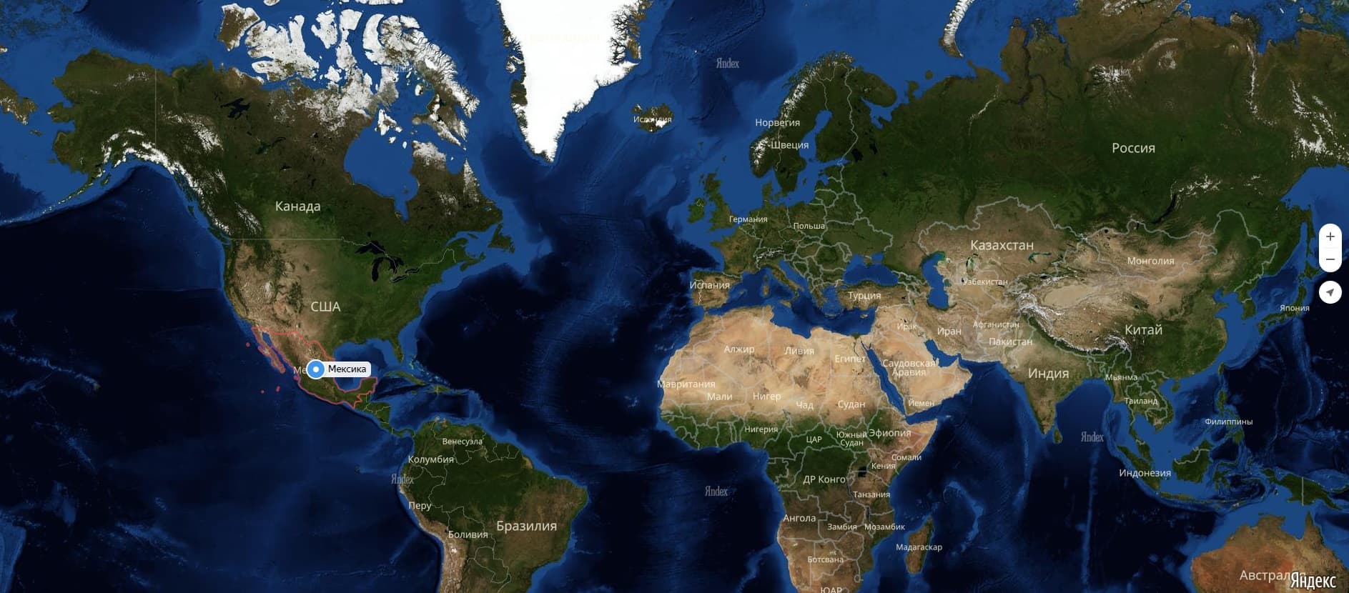
 Map of Mexico in Russian