Map of the Trans-Baikal Territory with settlements. Satellite map of the Trans-Baikal Territory High-resolution satellite map of the Trans-Baikal Territory
The online map of the Trans-Baikal Territory with borders shows that the region is located next to Buryatia, Yakutia (Sakha Republic), Irkutsk and Amur regions. The state borders of the Russian Federation in the south and southeast are adjacent to the territories of Mongolia and China. A satellite map of the Trans-Baikal Territory will help you to examine the territory of the region in detail.
Transport network of the Trans-Baikal Territory
Transport of the Trans-Baikal Territory on the map of Russia is represented by road, rail, air and inland waterways. The leading position in terms of passenger and freight traffic is occupied by road transport. Of great importance in its development is the Chita-Khabarovsk highway, which is under construction with a length of more than 2,000 km, running parallel to the Trans-Siberian Railway through the territories of the Trans-Baikal and Khabarovsk Territories, the Jewish Autonomous Okrug, and the Amur Region.
The main load in railway transportation is borne by the Trans-Baikal Railway, which passes through the Chita and Amur regions and represents part of the Baikal-Amur Mainline. Large stations - Chita, Khilok, Mogocha, Petrovsk-Zabaikalsky, Solovyovsk, Karymskaya, Shilka, Zabaikalsk, Borzya. From Zabaikalsk the railway lines go to the territory of the People's Republic of China, from Solovyovsk - to Mongolia
Air transportation is served by Chita International Airport and 2 other local airports, there are 43 landing sites. Water transportation is carried out only in the Sretensky region.
Map of the Trans-Baikal Territory with regions and settlements
The Transbaikal Territory includes 31 districts (Akshinsky, Petrovsk-Zabaikalsky, Baleysky, Khiloksky, Chitinsky, Borzinsky, Kalarsky, Transbaikalsky, Shilkinsky, etc.), of which three (Mogoituysky, Aginsky, Duldurginsky) as an administrative-territorial unit having special status, included in the Aginsky Buryat Okrug.
In addition to Chita, which is the administrative center, large cities and villages include: Krasnokamensk, Shilka, Ulety, Borzya, Petrovsk-Zabaikalsky, Zabaikalsk, Nerchinsk, Vershino-Darasunsky, Khilok and many others. etc. In total, the region has 882 settlements.
Transbaikal Territory is a region in Eastern Siberia, located in the east of Transbaikalia. A satellite map of the Trans-Baikal Territory shows that the region borders Mongolia, China, Buryatia, Yakutia, Irkutsk and Amur regions. Territory area – 431,892 sq. km.
Trans-Baikal Territory is divided into 31 districts. There are 10 cities, 41 urban settlements and 750 settlements in the region. The largest cities in the region are Chita (center), Krasnokamensk, Borzya, Petrovsk-Zabaikalsky, Aginskoye and Nerchinsk.
The economy of the Trans-Baikal Territory is based on mining, metallurgy, livestock farming, food industry and mechanical engineering. The region contains large reserves of coal, iron ore, timber and tin.
Chara Sands, Trans-Baikal Territory
Brief history of the Transbaikal region
The Trans-Baikal Territory was formed as a result of the merger of the Aginsky Buryat Autonomous Okrug and the Chita Region in 2008. Today it is the youngest subject of the Russian Federation.
In the 17th century, the development of Transbaikalia by Russians began. In the 19th century, the Transbaikal region was formed, which at the beginning of the 20th century became part of the Irkutsk General Government. During the Great Patriotic War, the Transbaikal Front was formed in this region.

The Great Source (Mount Pallas, Trans-Baikal Territory), from where water flows into three great rivers - Lena, Amur and Yenisei
Sights of the Trans-Baikal Territory
On a detailed map of the Trans-Baikal Territory you can see numerous natural attractions: Alkhanai National Park, Daursky Nature Reserve, Beklemishevsky Lakes and the Ivano-Arakhlei Lake System.
It is recommended to visit the following attractions in the Trans-Baikal Territory: the Shivanda mineral springs, the “Chara Sands” tract with moving shifting sands, Mount Alkhanay (a place of pilgrimage for Buddhists), the “Baysanids Lama town”, located at an altitude of 2000 m above sea level and the Konduisky Mongolian town of the 14th century . It is also worth visiting the largest cities in the region and seeing their attractions.
Maps of cities of the Trans-Baikal Territory: Chita | Baley | Borzya | Krasnokamensk | Mogocha | Nerchinsk | Petrovsk-Zabaikalsky | Sretensk | Khilok | Shilka
Trans-Baikal Territory on the map of Russia
The Trans-Baikal Territory is located in Eastern Siberia of Russia. It stretches from south to north for many thousands of kilometers. Its most extreme point is considered to be the Baikal-Amur Mainline. Plains and high mountains all belong to the topography of Transbaikalia.
The climate in the Trans-Baikal Territory is continental and harsh. Atmospheric precipitation is rare. It's cold in winter, cool in summer.
Scientists claim that life in this ecologically clean place began approximately long before modern days. It was somewhere between 35 and 150 thousand years ago. On the surface, archaeologists have recently found the first traces of human presence near the Khilok River. According to the latest census data, more than one million people now live in the region.
Look at the detailed map of the Trans-Baikal Territory with settlements, the territorial and administrative divisions are marked. These are more than 800 rural settlements, 42 urban villages and quite a lot of cities.
The attractions are the marble gorge. A mineral spring flows in this small valley. The house-museum of the wives of the Decembrists is located in the city of Zabaikalsky - Petrovsky. In it now you can see portals with bas-reliefs, monuments - crosses, sculptural compositions and so on. A map of the Trans-Baikal Territory can tell a lot of interesting things.
Map of the Trans-Baikal Territory from satellite. Explore the satellite map of the Trans-Baikal Territory online in real time. A detailed map of the Trans-Baikal Territory was created based on high-resolution satellite images. As close as possible, the satellite map of the Trans-Baikal Territory allows you to study in detail the streets, individual houses and attractions of the Trans-Baikal Territory. The map of the Trans-Baikal Territory from a satellite can easily be switched to regular map mode (diagram).
Transbaikal region, which is more often called simply Transbaikalia, is a region of Russia that is located in Siberia and borders several countries - Mongolia and China. The administrative center of the region is the city.
The climatic conditions in Transbaikalia are quite harsh, which is explained by the location of the Transbaikal region in the continental climate zone. Average winter temperatures reach -28...-29 C. Summer in the region is warm, but short. The average July temperature is +18…+19 C.
Main attractions Transbaikalia are classified as natural. On the territory of this region of Russia there are two large nature reserves - the Sokhondinsky and Daursky Nature Reserves. The Daursky Nature Reserve was founded relatively recently, in 1987, but is already of international importance. Its territory belongs not only to Russia, but also to Mongolia and China. In this protected area you can see more than 40 species of mammals, several hundred species of birds and more than 500 insects. There are also several large lakes in the Daursky Nature Reserve. The Sokhondinsky Nature Reserve is somewhat older and larger in area. It was founded in 1973 and is located in the Chita region.
Tourists are attracted to the Trans-Baikal Territory not only by natural sites and their beauty, but also by great opportunities for both active and relaxing recreation. The main tourist routes in Transbaikalia are hiking and water. Lovers of eco-tourism prefer to spend their free time in the lap of nature in nature reserves and national parks. Those who want to relax profitably and at the same time improve their health go to health resorts. Fortunately, there are a huge number of such in Transbaikalia, because more than 300 mineral springs have been discovered in the region to date.
The most famous resorts of the Trans-Baikal Territory are Darasun, Molokovka, Shivanda and Yamarovka.
 Hotels near the exhibition center Crocus Expo Exhibition in Crocus from March 14
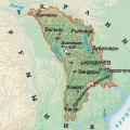 Map of moldova with cities
 School education in China How Russian children study in China