Map of europe countries only. Map of Europe with countries large in Russian. Countries of Foreign Europe
Europe is washed by the Atlantic and Arctic oceans and their seas.
The area of the islands is about 730 thousand km². The peninsulas account for about 1/4 of the territory of Europe (Kola, Scandinavian, Iberian, Apennine, Balkan, etc.).
The average height is about 300 m, the maximum (if you draw the border of Europe along the Kuma-Manych depression) - 4808 m, Mont Blanc, or (if you draw the border of Europe along the Caucasus ridge) - 5642 m, Elbrus, the minimum is currently approx. . −27 meters (Caspian Sea) and changes with fluctuations in the level of this sea.
Plains predominate (large - East European, Central European, Middle and Lower Danube, Paris Basin), mountains occupy about 17% of the territory (the main ones are the Alps, Caucasus, Carpathians, Crimean, Pyrenees, Apennines, Ural, Scandinavian mountains, mountains of the Balkan Peninsula) . There are active volcanoes in Iceland and the Mediterranean.
In most of the territory the climate is temperate (in the west - oceanic, in the east - continental, with snowy and frosty winters), on the northern islands - subarctic and arctic, in southern Europe - Mediterranean, in the Caspian lowland - semi-desert. There is glaciation on the Arctic islands, Iceland, the Scandinavian mountains, and the Alps (area over 116 thousand km²).
Main rivers: Volga, Danube, Ural, Dnieper, Western Dvina, Don, Pechora, Kama, Oka, Belaya, Dniester, Rhine, Elbe, Vistula, Tagus, Loire, Oder, Neman, Ebro.
Large lakes: Ladoga, Onega, Chudskoye, Venern, Balaton, Geneva.
On the Arctic islands and along the coast of the Arctic Ocean - Arctic deserts and tundras, to the south - forest-tundras, taiga, mixed and broad-leaved forests, forest-steppes, steppes, subtropical Mediterranean forests and shrubs; in the southeast there are semi-deserts.
The largest sandy desert in Europe, Ryn-Sands (40,000 km²), is located in the interfluve of the Volga and the Urals (on the territory of Kazakhstan and Russia); in Western Europe, the Tabernas massif in Spain, as well as the Nogai steppe in Russia in borderlands of Kalmykia, Dagestan and Chechnya. In addition, there has been desertification of vast areas in Kalmykia, Russia, as a result of human activities such as industrial water extraction from natural sources and unsustainable land use. In the zone of dry steppes in eastern Europe, there are a number of sandy massifs in Russia on the lower Don (Archedinsky-Don sands, Tsimlyansk sands, etc.), as well as in Ukraine (Aleshkovsky sands).
Andreas Kaplan believes that Europe is the region with the greatest cultural diversity in a relatively small geographical area.
Interactive map of Europe online with cities. Satellite and classic maps of Europe
Europe is a part of the world located in the northern hemisphere of the Earth (on the continent of Eurasia). The map of Europe shows that its territory is washed by the seas of the Atlantic and Arctic oceans. The area of the European part of the continent is more than 10 million square kilometers. This territory is home to approximately 10% of the Earth's population (740 million people).
Satellite map of Europe at night
Geography of Europe
In the 18th century V.N. Tatishchev proposed to accurately determine the eastern border of Europe: along the ridge of the Ural Mountains and the Yaik River to the Caspian Sea. Currently, on a satellite map of Europe you can see that the eastern border runs along the eastern foot of the Ural Mountains, along the Mugodzharam Mountains, along the Emba River, the Caspian Sea, the Kuma and Manych rivers, as well as along the mouth of the Don.
Approximately ¼ of Europe's territory is on peninsulas; 17% of the territory is occupied by mountains such as the Alps, Pyrenees, Carpathians, Caucasus, etc. The highest point in Europe is Mont Blanc (4808 m), and the lowest is the Caspian Sea (-27 m). The largest rivers of the European part of the continent are the Volga, Danube, Dnieper, Rhine, Don and others.

Mont Blanc Peak - the highest point in Europe
European countries
The political map of Europe shows that approximately 50 states are located on this territory. It is worth noting that only 43 states are officially recognized by other countries; five states are only partially located in Europe, and 2 countries have limited or no recognition by other countries.
Europe is often divided into several parts: Western, Eastern, Southern and Northern. Western European countries include Austria, Belgium, Great Britain, Germany, Liechtenstein, Ireland, France, Monaco, Luxembourg, Switzerland and the Netherlands.
In Eastern Europe there are Belarus, Slovakia, Bulgaria, Ukraine, Moldova, Hungary, the Czech Republic, Poland and Romania.

Political map of Europe
The Scandinavian and Baltic countries are located in Northern Europe: Denmark, Norway, Estonia, Latvia, Lithuania, Sweden, Finland and Iceland.
Southern Europe is San Marino, Portugal, Spain, Italy, Vatican City, Greece, Andorra, Macedonia, Albania, Montenegro, Serbia, Bosnia and Herzegovina, Croatia, Malta and Slovenia.
Partially located in Europe are countries such as Russia, Türkiye, Kazakhstan, Georgia and Azerbaijan. Unrecognized entities include the Republic of Kosovo and the Transnistrian Moldavian Republic.

Danube River in Budapest
Politics of Europe
In the sphere of politics, the leaders are the following European countries: France, Germany, Great Britain and Italy. Today, 28 European countries are part of the European Union, a supranational association that determines the political, trade and monetary activities of the participating countries.
Also, many European countries are members of NATO, a military alliance in which, in addition to European countries, the United States and Canada participate. Finally, 47 states are members of the Council of Europe, an organization that implements programs to protect human rights, protect the environment, etc.

Events on Maidan in Ukraine
As of 2014, the main centers of instability are Ukraine, where hostilities unfolded after Russia’s annexation of Crimea and the events on the Maidan, as well as the Balkan Peninsula, where problems that arose after the collapse of Yugoslavia have still not been resolved.
Europe is part of the continent of Eurasia. This part of the world is home to 10% of the world's population. Europe owes its name to the heroine of ancient Greek mythology. Europe is washed by the seas of the Atlantic and Arctic oceans. Inland seas - Black, Mediterranean, Marmara. The eastern and southeastern border of Europe runs along the Ural Range, the Emba River and the Caspian Sea.
In Ancient Greece, they believed that Europe was a separate continent that separated the Black and Aegean Seas from Asia, and the Mediterranean Sea from Africa. Later it was found that Europe is only part of a huge continent. The area of the islands that make up the continent is 730 thousand square kilometers. 1/4 of the territory of Europe falls on the peninsulas - Apennine, Balkan, Kola, Scandinavian and others.
The highest point in Europe is the peak of Mount Elbrus, which is 5642 meters above sea level. A map of Europe with cities shows that the largest lakes in the region are Geneva, Chudskoye, Onega, Ladoga and Balaton.
All European countries are divided into 4 regions - Northern, Southern, Western and Eastern. Europe consists of 65 countries. 50 countries are independent states, 9 are dependent and 6 are unrecognized republics. Fourteen countries are islands, 19 are inland, and 32 countries have access to oceans and seas. The map of Europe in Russian shows the borders of all European states. The three states have their territories in both Europe and Asia. These are Russia, Kazakhstan and Türkiye. Spain, Portugal and France have part of their territory in Africa. Denmark and France have their territories in America.
The European Union includes 27 countries, and the NATO bloc includes 25. There are 47 states in the Council of Europe. The smallest state in Europe is the Vatican, and the largest is Russia.
The collapse of the Roman Empire marked the beginning of the division of Europe into Eastern and Western. Eastern Europe is the largest region of the continent. In Slavic countries the Orthodox religion predominates, in the rest - Catholicism. Cyrillic and Latin scripts are used. Western Europe unites Latin-speaking states. This part of the continent is the most economically developed part in the world. The Scandinavian and Baltic states unite to form Northern Europe. South Slavic, Greek and Romance-speaking countries form Southern Europe.
Foreign Europe is part of the European mainland and several islands, occupying a total area of about 5 million square meters. km. Approximately 8% of the world's population lives here. Using a map of Foreign Europe by geography, you can determine the size of this region:
- from north to south its territory occupies 5 thousand km;
- from east to west, Europe stretches for almost 3 thousand km.
The region has a fairly diverse topography - there are flat and hilly areas, mountains and coastal coasts. Thanks to this geographical location, Europe has different climatic zones. Foreign Europe is in a favorable geographical and economic position. It is conventionally divided into four areas:
- western;
- eastern;
- northern;
- southern
Each region includes about a dozen countries.

Rice. 1. Overseas Europe is shown in blue on the map.
Traveling from one end of Europe to the other, you can visit eternal glaciers and subtropical forests.
Countries of Foreign Europe
Foreign Europe was formed by four dozen countries. There are other countries on the European continent, but they do not belong to Foreign Europe, but are part of the CIS.
TOP 4 articleswho are reading along with this
Countries include republics, principalities, and kingdoms. Each of them has its own natural resources.
Almost all countries have maritime borders or are located a short distance from the sea. This opens up additional trade and economic routes. The countries of Foreign Europe on the map are mostly small in size. This is especially noticeable in comparison with Russia, China, the USA and Canada. However, this does not prevent them from being one of the most highly developed in the world.

Rice. 2. Countries of Foreign Europe
Almost the entire population belongs to the Indo-European group, with the exception of emigrants from other countries. Most of the population preaches Christianity. Europe is one of the most urbanized regions, meaning that about 78% of the total population lives in cities.
The table below shows European countries and capitals, indicating the number of inhabitants and area.
Table. Composition of Foreign Europe.
|
A country |
Capital |
Population, million people |
Area, thousand sq. km. |
|
Andorra la Vella |
|||
|
Brussels |
|||
|
Bulgaria |
|||
|
Bosnia and Herzegovina |
|||
|
Budapest |
|||
|
Great Britain |
|||
|
Germany |
|||
|
Copenhagen |
|||
|
Ireland |
|||
|
Iceland |
Reykjavik |
||
|
Liechtenstein |
|||
|
Luxembourg |
Luxembourg |
||
|
Macedonia |
|||
|
Valletta |
|||
|
Netherlands |
Amsterdam |
||
|
Norway |
|||
|
Portugal |
Lisbon |
||
|
Bucharest |
|||
|
San Marino |
San Marino |
||
|
Slovakia |
Bratislava |
||
|
Slovenia |
|||
|
Finland |
Helsinki |
||
|
Montenegro |
Podgorica |
||
|
Croatia |
|||
|
Switzerland |
|||
|
Stockholm |
|||
As you can see, the geographical picture of Foreign Europe is very diverse. The countries that make up it can be divided into several groups according to their location.
- Inland, that is, not having borders with the sea. This includes 12 countries. Examples - Slovakia, Hungary.
- Four countries are islands, or located entirely on islands. An example is Great Britain.
- Peninsulars are located entirely or partially on a peninsula. For example, Italy.

Rice. 3. Iceland is one of the island countries of Europe
The most highly developed economically and technically are four European countries - Italy, Great Britain, Germany, France. They are part of the G7 along with Canada, Japan and the United States.
What have we learned?
Foreign Europe is a relatively small area of the European continent, including 40 countries. Most of them have sea borders, some are located on islands. The geographical location of European countries is in most cases favorable. Foreign Europe has connections with the whole world.
Test on the topic
Evaluation of the report
Average rating: 4.7. Total ratings received: 137.
Here is a map of countries in Russian and a table with sovereign states, as well as dependent territories. They include completely independent states and territories dependent on various European countries. In total, in the European part of the world there are 50 sovereign states and 9 dependent territories.
According to the generally accepted geographical definition, the border between and Europe runs along the Ural Mountains, the Ural River and the Caspian Sea in the east, the Greater Caucasus mountain system and the Black Sea with its outlets, the Bosphorus and the Dardanelles in the south. Based on this division, the transcontinental states of Azerbaijan, Georgia, Kazakhstan, Russia and Turkey have territories in both Europe and Asia.
The island of Cyprus in Western Asia is close to Anatolia (or Asia Minor) and lies on the Anatolian Plate, but is often considered part of Europe and is a current member of the European Union (EU). Armenia is also entirely in Western Asia, but is a member of some European organizations.
Although providing a clearer separation between and Europe, some traditionally European islands, such as Malta, Sicily, Pantelleria and the Pelagian Islands, are located on the African Continental Plate. The island of Iceland is part of the Mid-Atlantic Ridge, which crosses the Eurasian and North American plates.
Greenland has socio-political ties to Europe and is part of the Kingdom of Denmark, but is geographically closer to. Sometimes Israel is also seen as part of the geopolitical processes of Europe.
Other territories are part of European countries but are geographically located on other continents, such as the French overseas departments, the Spanish cities of Ceuta and Melilla on the African coast, and the Dutch Caribbean territories of Bonaire, Saba and Sint Eustatius.
There are 50 internationally recognized sovereign states with territory located within the general definition of Europe and/or members in international European organizations, of which 44 have their capitals within Europe. All but the Vatican are members of the United Nations (UN), and all but Belarus, Kazakhstan and the Vatican are members of the Council of Europe. 28 of these countries have been members of the EU since 2013, meaning they are highly integrated with each other and partially share their sovereignty with EU institutions.
Political map of Europe with country names in Russian
To enlarge the map, click on it.
Political map of Europe with names of states/Wikipedia
Table of European countries with capitals
Eastern European states |
||
| № | Titles | Capital Cities |
| 1 | Belarus | Minsk |
| 2 | Bulgaria | Sofia |
| 3 | Hungary | Budapest |
| 4 | Moldova | Kishinev |
| 5 | Poland | Warsaw |
| 6 | Russia | Moscow |
| 7 | Romania | Bucharest |
| 8 | Slovakia | Bratislava |
| 9 | Ukraine | Kyiv |
| 10 | Czech | Prague |
Western European countries |
||
| № | Titles | Capital Cities |
| 1 | Austria | Vein |
| 2 | Belgium | Brussels |
| 3 | Great Britain | London |
| 4 | Germany | Berlin |
| 5 | Ireland | Dublin |
| 6 | Liechtenstein | Vaduz |
| 7 | Luxembourg | Luxembourg |
| 8 | Monaco | Monaco |
| 9 | Netherlands | Amsterdam |
| 10 | France | Paris |
| 11 | Switzerland | Berne |
Nordic states |
||
| № | Titles | Capital Cities |
| 1 | Denmark | Copenhagen |
| 2 | Iceland | Reykjavik |
| 3 | Norway | Oslo |
| 4 | Latvia | Riga |
| 5 | Lithuania | Vilnius |
| 6 | Finland | Helsinki |
| 7 | Sweden | Stockholm |
| 8 | Estonia | Tallinn |
Southern European states |
||
| № | Titles | Capital Cities |
| 1 | Albania | Tirana |
| 2 | Andorra | Andorra la Vella |
| 3 | Bosnia and Herzegovina | Sarajevo |
| 4 | Vatican | Vatican |
| 5 | Greece | Athens |
| 6 | Spain | Madrid |
| 7 | Italy | Rome |
| 8 | Macedonia | Skopje |
| 9 | Malta | Valletta |
| 10 | Portugal | Lisbon |
| 11 | San Marino | San Marino |
| 12 | Serbia | Belgrade |
| 13 | Slovenia | Ljubljana |
| 14 | Croatia | Zagreb |
| 15 | Montenegro | Podgorica |
Asian states that are partly located in Europe |
||
| № | Titles | Capital Cities |
| 1 | Kazakhstan | Astana |
| 2 | Türkiye | Ankara |
States that, taking into account the border between Europe and Asia along the Caucasus, are partly located in Europe |
||
| № | Titles | Capital Cities |
| 1 | Azerbaijan | Baku |
| 2 | Georgia | Tbilisi |
States that are located in Asia, although from a geopolitical point of view they are closer to Europe |
||
| № | Titles | Capital Cities |
| 1 | Armenia | Yerevan |
| 2 | Republic of Cyprus | Nicosia |
Dependent territories |
||
| № | Titles | Capital Cities |
| 1 | Åland (autonomy within Finland) | Mariehamn |
| 2 | Guernsey (a British Crown Dependency that is not part of Great Britain) | St Peter Port |
| 3 | Gibraltar (British overseas possessions disputed by Spain) | Gibraltar |
| 4 | Jersey (a British Crown Dependency that is not part of Great Britain) | St Helier |
| 5 | Isle of Man (British Crown Dependency) | Douglas |
| 6 | Faroe Islands (autonomous island region, part of Denmark) | Tórshavn |
| 7 | Svalbard (an archipelago in the Arctic Ocean that is part of Norway) | Longyearbyen |
 Hotels near the exhibition center Crocus Expo Exhibition in Crocus from March 14
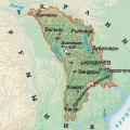 Map of moldova with cities
 School education in China How Russian children study in China